Forestry England Roads

Captain Stupido

Senior Retro Guru
Feedback
View
Probably a silly question, but I was born in London, so when it comes to riding off road I'm still a clueless townie in many respects.

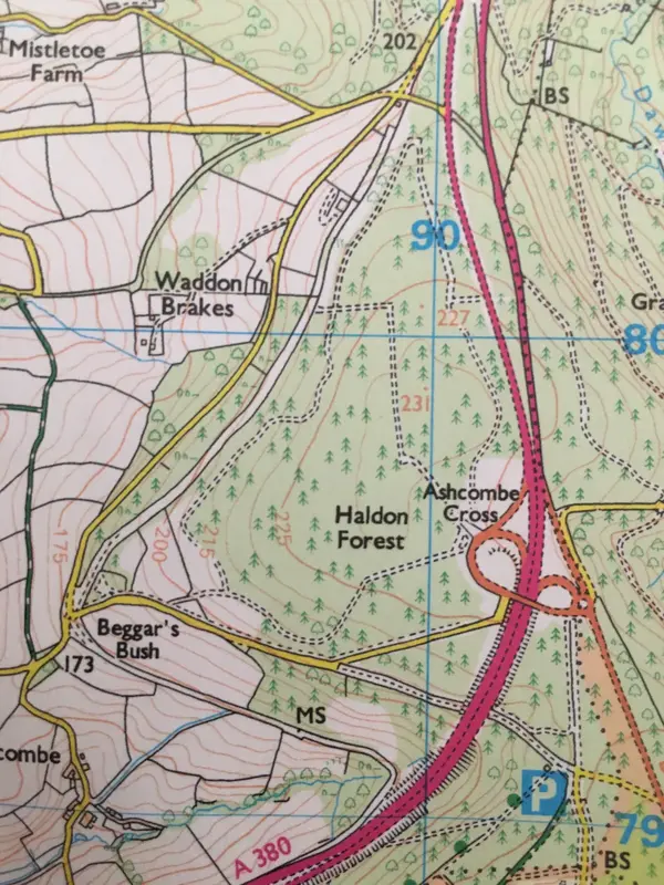
Now I'm lucky enough to live in Devon. There are quite a few Forestry England sites around here, centred around Haldon which has designated bike and walking trails. There are also miles of forest roads at the main site and other smaller sites nearby. The woods are all open to public access and mainly seem to be popular with dog walkers.

Forestry England don't seem to publish any information on the public use of forest roads. They're obviously not accessible to cars as they're usually gated, but walking is not an issue. What's the score officially with cycling on them? I've done it, but I'm never sure whether it's either legal or socially acceptable!

It's funny, when you look at the Forestry website they tell you all about the designated trails but there's no mention of the forest roads. I've just been looking at some maps and noticed a nice little loop at a local woods... it seems they don't exactly encourage it, but they don't tell you not to do it either!
 
I am a member of Forestry England and cycling on the forest roads is fine with the usual caveat for awareness of other people or forestry operations. Mentioned in the trail grading bit on their website.
View attachment 974215

Great share👍

I don't think forestry England or NRW want to imply or create a right, so it's hard for them to express their support for cyclists.

I do worry that hordes of ebikes might make cyclists less welcome in certain areas - but so far so good.
 
If you steer clear of anything marked as public footpath on the map or by a sign then usually your fine if it’s a rideable surface. That said some of the forest tracks could be designated footpaths that happen to be tracks big enough for bikes to share. While they don’t go out of their way to designate what you can ride they usually do mark stuff like wheelchair routes as areas not for cycling. If you do stray off somewhere you shouldn’t be and it’s not obvious most people are quite understanding.


If you start having to lift your bike over locked gates with private land signs or end up in someone’s garden then you’ve gone too far!
 
In the UK (other countries vary) our rights are shown on the Ordnance Survey maps. Footpaths for walking, bridleways for cycling and walking and rights to roam (on foot) across any Open Access Land.
I'm close to Thetford Forest and all three rights are present in various places. The landowner has to honour these rights.

That's a useful screen grab. It seems like Forestry England permit cycling on Forest Roads. That's not a right, but a permission from the landowner. There ought to be a description of what defines a 'Forest Road' to additionally remove any ambiguity!

I've several woods near where I live which I often cycle around. There are no rights of way and no indication of the landowner! However all the woods are well used by the general public.
 
Interesting stuff. I usually look for bridleways and green lanes (often it seems these are marked ambiguously) on OS maps as being cycle friendly - forestry roads are also indicated but as above I've struggled to ascertain what the rules are re usage.

At the main Haldon site many of the designated cycle routes use forest roads for short stretches but they don't clarify usage elsewhere.

Attached is one of the areas I've been considering. I'm embarrassed to admit that I wasn't aware that open access land was marked on OS maps!

That being said as someone with red/green colour vision deficiency it's actually really hard for me to identify the yellow wash on the map - and particularly to tell it apart from green which identifies forests - which presumably may or may not be open access? I'm probably missing something here thanks to my faulty eyes. I think it would be worthwhile subscribing to the online version of OS as it seems they offer CVD accessible maps via that platform. I must look into it.
 

Attachments

  • IMG_7443.webp
    IMG_7443.webp
    389 KB · Views: 5
In the UK (other countries vary) our rights are shown on the Ordnance Survey maps. Footpaths for walking, bridleways for cycling and walking and rights to roam (on foot) across any Open Access Land.
I'm close to Thetford Forest and all three rights are present in various places. The landowner has to honour these rights.

That's a useful screen grab. It seems like Forestry England permit cycling on Forest Roads. That's not a right, but a permission from the landowner. There ought to be a description of what defines a 'Forest Road' to additionally remove any ambiguity!

I've several woods near where I live which I often cycle around. There are no rights of way and no indication of the landowner! However all the woods are well used by the general public.

The problem with removing ambiguity is that it starts to imply rights, so landowners then often go for an outright ban.

Given the Cameron government wanted to sell off all the national forestry, its worth a lot less if you've implied rights of way across it...🤔
 
https://www.forestryengland.uk/know-before-you-go

would appear to feature a picture of father and son on MTBs - plus there is no mention of any limitations on cycling in the guidance therein - seems to suggest as per advice above in this thread, that respect for other users of the facility is the main code of conduct.

and in https://www.forestryengland.uk/cycling-safety

Forest road and similar​

  • Forest roads are suitable for: a wide range of cyclists.
  • Bike required: most bikes and mountain bike hybrids are suitable
  • Skills needed: basic map reading will be helpful for roads which are not waymarked or signposted
  • Trail and surface types: relatively flat and wide. The trail surface might be loose, uneven or muddy at times. These roads might be also be used by vehicles and others including horse riders and dog walkers.
  • Gradients and technical trail features: gradients can be very variable and might include short, steep sections. Occasional potholes might be present. Routes might not be waymarked or signposted.
  • Suggested fitness level: a good standard of fitness can help.
 
A small part of my ride today was through Forestry England land. So many ways we could have taken through this area that aren’t marked as even paths. Once you’re there on the ground it’s obvious where you can and can’t go. Even the footpaths marked to the top of the forest are actual double width tracks when you’re on them. Everything dotted in the map was easily accessible by bike and there were many more not marked that you could ride.

A combination of OSMaps with a subscription can be invaluable with route planning. Sometimes combined with a look on street view to see if the end of a non designated track is gated/signposted.


IMG_6301.webp
 
Here's the link to Bing maps of that area, in Ordance Survey mode. Might depend on your monitor how clear the colours are too. The screenshot:
A380 Haldon.webp
The access land also has a tinted border which helps it to show up better.
 
Back
Top