5/7/2011 Lambley. Start point Lambley. 13.1m Height gain 1296ft. Details a little scant on this one as this route was taken from someone else's GPS.
The route was shortened due to various technical mishaps! Enjoyable terrain with fine views over the surrounding countryside. Done on a dry (until the end!) summer's evening. The paths tend towards washboard which can be jarring on rigid or hardtail.
21/8/2011 Linacre Reservoirs, nr Chesterfield 17.7m height gain 2549ft. Start point one of the car parks above Linacre Reservoirs. Best done clockwise, although we did it anti-clockwise.
This route was done on a lovely dry summer's day. We did this route anti-clockwise, but I think personally it is much better done clockwise (I have done it this way in previous years). This route takes in a part of the Peak District that is off the beaten track, we hardly encountered anybody along the whole way. It takes you down deep valleys, up onto moorland and along quiet country roads. In winter it can be a very muddy ride, however today it was dry and all rideable. There is a lot of climbing to be done - don't expect many flat sections!
You'll note there is a slight kink in our route in the bottom left hand corner, just below Wigley. This was a very welcome detour to the Fox and Goose pub - recommended!
21.9.2011 Bardon Hill and Charnwood. 12.1m, 1164ft. Start point car park behind Bull's Head pub on the edge of Thringstone. P.250.
Done on a dark wet autumn night, this route has some lovely singletrack sections through woods, with slippery roots and the odd unexpected hole. It gradually rises as you approach Bardon Hill (and the quarry). Although the last bit isn't rideable to reach the trig point, it's worth the extra short walk for the view (even on a dark night the quarry is still working). This is the highest point in the East Midlands (allegedly, although I think the Peaks should count really.... ). The route then largely retraces its steps generally downhill back to the start point.
Charnwood 2.10.11. 17.7m, 1400ft. Start point, car park off Main Street in Woodhouse Eaves.
This was done on an extraordinary warm day in early October, fabulous riding conditions. Trails dry and dusty and a great cafe at Newtown Linford. Not a very hilly route except for Beacon Hill, which offers great views over the East Midlands.
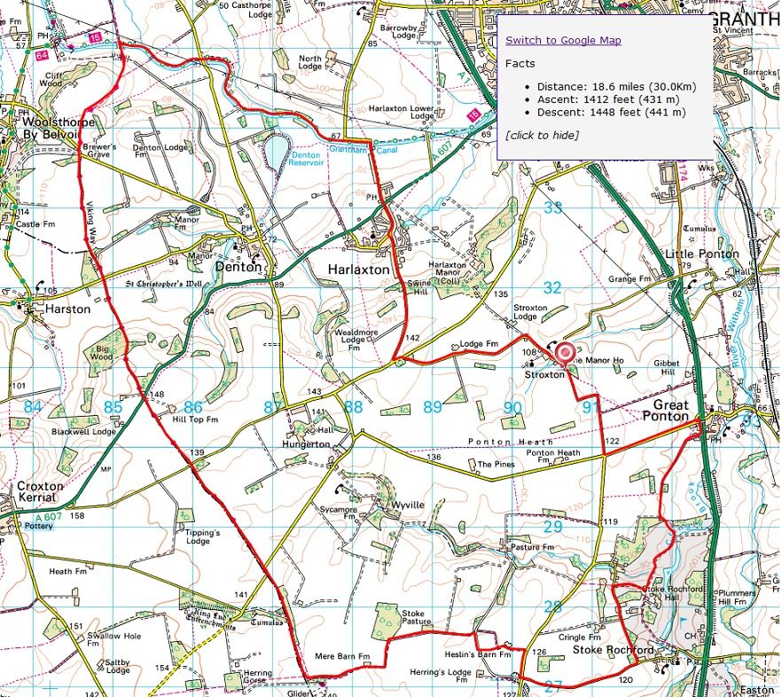
Vale of Belvoir 13.11.11. 18.75m, 1500ft. Start point Stroxton.
Excellent ride covering bridleways, a legal blast across a golf course and a very enjoyable and picturesque section of the Viking Way.
There are two technical downhill sections and the final blast along the Grantham Canal is tempered by a cheeky little climb up the appropriately named Swine Hill before a quick road ride back to the start point.
Not too muddy but could be quite a slog in places during the depths of winter.
Charnwood 17.1.2012. 12.7m, 1180ft. Start point car park in centre of Woodhouse Eaves.
This was a very pleasant winter's night ride for most of us except Steve (inzaman) who managed to have various mechanicals and a fall at the end seriously buckling his wheel :shock: The route takes in some brilliant woodland and also Beacon Fell.


 ). The route then largely retraces its steps generally downhill back to the start point.